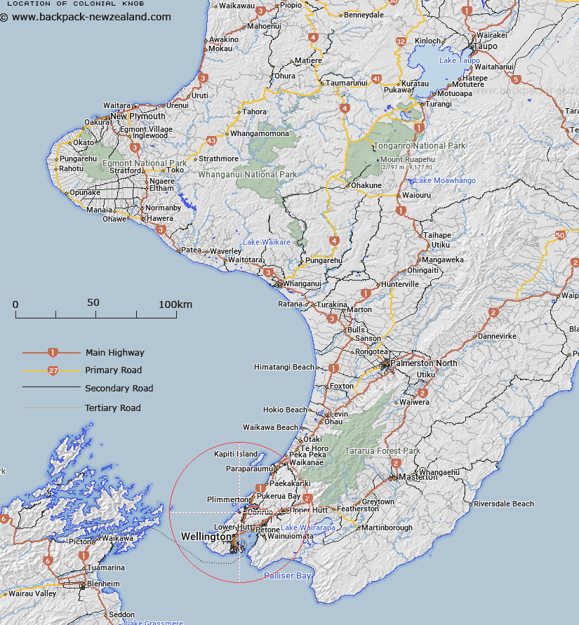
Map showing location of Colonial Knob


LINZ description: New locality name. NZTopo50 BP31-Porirua, GR 518 450.
Latitude: -41.131711
Longitude: 174.808408
Northing: 5445045.6
Easting: 1751790.2
Land District: Wellington
Feat Type: Locality


Scroll down to see a more detailed road map and below that a topographical map showing the location of Colonial Knob. The road map has been supplied by openstreetmap and the topographical map of Colonial Knob has been supplied by Land Information New Zealand (LINZ).

Yes you can use the top static map for you school/university project or personal website with a link back. Contact me for any commercial use.

Colonial Knob Map New Zealand


New Zealand places in our database
[ A ] [ B ] [ C ] [ D ] [ E ] [ F ] [ G ] [ H ] [ I ] [ J ] [ K ] [ L ] [ M ] [ N ] [ O ] [ P ] [ Q ] [ R ] [ S ] [ T ] [ U ] [ V ] [ W ] [ X ] [ Y ] [ Z ]


Closest 20 Localitys to Colonial Knob

Mana Island ( 5.45km )   Hongoeka ( 9.14km )   Te Hikowhenua ( 11.24km )   Judgeford ( 11.84km )   Ngahauranga ( 12.64km )   Ngauranga ( 12.64km )   Makara Beach ( 12.7km )   Nai Nai ( 13.63km )   Naenae ( 13.63km )   Ngae Ngae ( 13.63km )   Te Kaianga ( 14.07km )   Te Kainga ( 14.07km )   Paek?k?riki Hill ( 14.18km )   Kaiwharawhara ( 14.3km )   Kaiwhara ( 14.3km )   Kaiwarawara ( 14.3km )   Kaiwara ( 14.3km )   Haywards ( 14.49km )   Makara ( 17.55km )   Te Ramaroa ( 22.9km )   MacKays Crossing ( 23.05km )   Mackays Crossing ( 23.05km )   Whitemans Valley ( 23.42km )   Whareroa ( 24.04km )   Mangaroa ( 25.47km )   Te Marua ( 27.04km )   Maymorn ( 27.48km )   The Plateau ( 27.76km )   Cloustonville ( 29.66km )   Kaitoke ( 30.79km )   Otaihanga ( 32.89km )   Cross Creek ( 33.89km )   Pakuratahi ( 34km )   Reikorangi ( 34.64km )   Wharekauhau ( 35.51km )   Pigeon Bush ( 37.9km )   Peka Peka ( 39.4km )   Lake Ferry ( 40.24km )   Kohunui Maori Settlement ( 40.85km )   Pirinoa ( 40.95km )