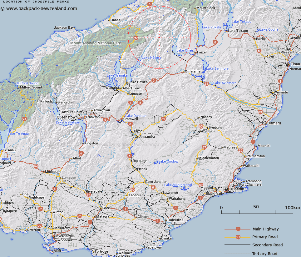
Map showing location of Chosspile Peaks


LINZ description: Comprises of two peaks with a 250 m flat ridge between them on the western side of upper Ahuriri River.
Latitude: -44.079598
Longitude: 169.658316
Northing: 5113855.3
Easting: 1332436.8
Land District: Otago
Feat Type: Hill


Scroll down to see a more detailed road map and below that a topographical map showing the location of Chosspile Peaks. The road map has been supplied by openstreetmap and the topographical map of Chosspile Peaks has been supplied by Land Information New Zealand (LINZ).

Yes you can use the top static map for you school/university project or personal website with a link back. Contact me for any commercial use.

Chosspile Peaks Map New Zealand


New Zealand places in our database
[ A ] [ B ] [ C ] [ D ] [ E ] [ F ] [ G ] [ H ] [ I ] [ J ] [ K ] [ L ] [ M ] [ N ] [ O ] [ P ] [ Q ] [ R ] [ S ] [ T ] [ U ] [ V ] [ W ] [ X ] [ Y ] [ Z ]


Closest 20 Hills to Chosspile Peaks

Mount Huxley ( 1.88km )   Abseil Peak ( 2.59km )   College Peak ( 3.99km )   Pakeke Peak ( 4.39km )   Protuberance Peak ( 4.99km )   Stevenson Peak ( 5.23km )   Mount Hammerack ( 5.35km )   Mount Wyn Irwin ( 5.41km )   Soloist Peak ( 5.58km )   Paku Peak ( 6.83km )   Mount Calvin ( 7.08km )   Temple Peak ( 7.6km )   Mount Ferguson ( 7.62km )   Belfry Peak ( 7.67km )   Hiwiroa Mount ( 8.14km )   Anita Peak ( 8.52km )   Mount Enderby ( 8.53km )   Bruce Peak ( 8.91km )   Steeple Peak ( 9.16km )   Mount Holdsworth ( 9.17km )   Mount Tylee ( 9.32km )   Mount Greenfield ( 9.72km )   Rabbiters Peak ( 9.89km )   Mount Barth ( 9.92km )   Mount Maitland ( 10.03km )   Docherty Peak ( 11.54km )   Elusive Peak ( 11.57km )   Mount Heim ( 11.88km )   Mount Tole ( 11.9km )   Hassing Peak ( 12.38km )   Mount Wray ( 12.63km )   Mount Marshman ( 12.69km )   Shingle Hill ( 12.82km )   Ram Hill ( 13.01km )   Mount Giles ( 13.11km )   Mount Pearson ( 13.15km )   Adams Peak ( 13.46km )   Mount Strauchon ( 13.49km )   Boanerges ( 13.64km )   Mount Maitland ( 13.72km )