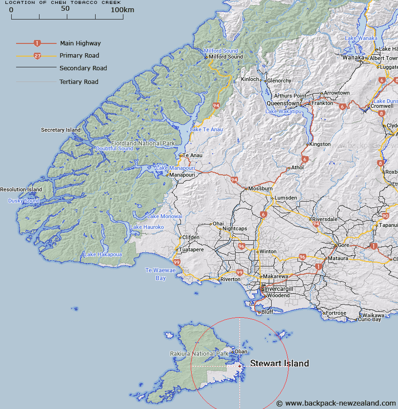
Map showing location of Chew Tobacco Creek


LINZ description: Stream flowing into northern portion of Chew Tobacco Bay, Stewart Island. Paterson Survey District.
Latitude: -47.004911
Longitude: 168.184148
Northing: 4783025
Easting: 1233935.6
Land District: Southland
Feat Type: Stream


Scroll down to see a more detailed road map and below that a topographical map showing the location of Chew Tobacco Creek. The road map has been supplied by openstreetmap and the topographical map of Chew Tobacco Creek has been supplied by Land Information New Zealand (LINZ).

Yes you can use the top static map for you school/university project or personal website with a link back. Contact me for any commercial use.

Chew Tobacco Creek Map New Zealand


New Zealand places in our database
[ A ] [ B ] [ C ] [ D ] [ E ] [ F ] [ G ] [ H ] [ I ] [ J ] [ K ] [ L ] [ M ] [ N ] [ O ] [ P ] [ Q ] [ R ] [ S ] [ T ] [ U ] [ V ] [ W ] [ X ] [ Y ] [ Z ]


Closest 20 Streams to Chew Tobacco Creek

Heron River ( 6.09km )   Fifes Creek ( 7.01km )   Euchre Creek ( 12km )   Lords River/T?taekawetoweto ( 12.39km )   Lords River ( 12.39km )   Ryans Creek ( 12.89km )   Mill Creek ( 14.36km )   Gorge Creek ( 16.38km )   Little River ( 16.49km )   Ogles Creek ( 16.71km )   Toitoi River ( 19.08km )   Duck Creek ( 20.37km )   Topeheti Creek ( 21.43km )   Kirklands Creek ( 22.76km )   Newton Creek ( 22.82km )   Tolson River ( 23.24km )   Little River ( 23.24km )   Waterfall Creek ( 24.14km )   Kopeka River ( 24.79km )   Duck Creek ( 25.92km )   Bullers Creek ( 26.05km )   Arnetts Creek ( 26.16km )   Rakeahua River ( 26.21km )   Blaikies Creek ( 26.54km )   Scott Burn ( 27.42km )   Freshwater River ( 28.03km )   Murray River ( 28.96km )   Seal Creek ( 29.53km )   Forked Creek ( 31.08km )   Duck Creek ( 31.54km )   Martins Creek ( 32.15km )   Double Creek ( 32.62km )   Wreck Creek ( 32.9km )   Saddle Creek ( 33.22km )   Doughboy Creek ( 33.33km )   Cavalier Creek ( 34.33km )   Robertson River ( 34.68km )   Leask Creek ( 36.26km )   Maori Creek ( 36.36km )   McArthurs Creek ( 37.44km )