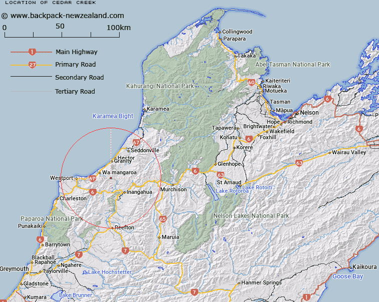
Map showing location of Cedar Creek


LINZ description: Feature shown on: NZMS260 L29 Edition 2 1996
Latitude: -41.750111
Longitude: 171.849
Northing: 5377328
Easting: 1504304.1
Land District: Nelson
Feat Type: Stream


Scroll down to see a more detailed road map and below that a topographical map showing the location of Cedar Creek. The road map has been supplied by openstreetmap and the topographical map of Cedar Creek has been supplied by Land Information New Zealand (LINZ).

Yes you can use the top static map for you school/university project or personal website with a link back. Contact me for any commercial use.
Cedar Creek Map New Zealand


New Zealand places in our database
[ A ] [ B ] [ C ] [ D ] [ E ] [ F ] [ G ] [ H ] [ I ] [ J ] [ K ] [ L ] [ M ] [ N ] [ O ] [ P ] [ Q ] [ R ] [ S ] [ T ] [ U ] [ V ] [ W ] [ X ] [ Y ] [ Z ]


Closest 20 Streams to Cedar Creek

Cedar Creek ( 0km )   Gomorrah Creek ( 1.21km )   Wilderness Stream ( 2.06km )   Hut Stream ( 2.2km )   Stevenson Stream ( 2.5km )   Deep Stream ( 2.56km )   Mount William Stream ( 2.75km )   Wilson Creek ( 2.78km )   Saddle Stream ( 2.87km )   Burnett Stream ( 2.92km )   L75 Stream ( 3.12km )   Billo Stream ( 3.66km )   Ernest Stream ( 4.02km )   Mishap Stream ( 4.11km )   Webb Stream ( 4.39km )   Kereru Stream ( 4.44km )   Dooley Stream ( 4.71km )   Archer Stream ( 4.94km )   Hagan Creek ( 5.03km )   Herbert Stream ( 5.08km )   Cypress Stream ( 5.2km )   V8 Creek ( 5.38km )   Plateau Stream ( 5.8km )   Britannia Stream ( 5.85km )   Whirlwind Stream ( 5.88km )   S Creek ( 5.98km )   Conns Creek ( 6km )   Rahui Creek ( 6.07km )   V37 Creek ( 6.42km )   V40 Stream ( 6.48km )   Tiger Stream ( 6.54km )   Trent Stream ( 6.79km )   Orikaka or Mackley River ( 6.85km )   Fall Stream ( 7.09km )   Tiger Pakihi ( 7.18km )   Rapid Stream ( 7.23km )   Payne Creek ( 7.42km )   Plover Stream ( 7.52km )   Conglomerate Stream ( 7.66km )   Kiwi Creek ( 7.72km )