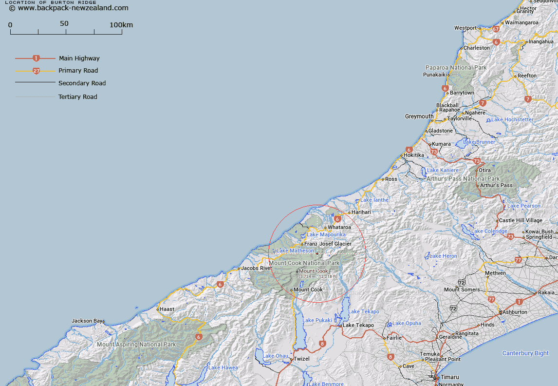
Map showing location of Burton Ridge


LINZ description: Runs north-westerly from Elie de Beamont
Latitude: -43.456171
Longitude: 170.298577
Northing: 5184981
Easting: 1381442.8
Land District: Westland
Feat Type: Ridge


Scroll down to see a more detailed road map and below that a topographical map showing the location of Burton Ridge. The road map has been supplied by openstreetmap and the topographical map of Burton Ridge has been supplied by Land Information New Zealand (LINZ).

Yes you can use the top static map for you school/university project or personal website with a link back. Contact me for any commercial use.

Burton Ridge Map New Zealand


New Zealand places in our database
[ A ] [ B ] [ C ] [ D ] [ E ] [ F ] [ G ] [ H ] [ I ] [ J ] [ K ] [ L ] [ M ] [ N ] [ O ] [ P ] [ Q ] [ R ] [ S ] [ T ] [ U ] [ V ] [ W ] [ X ] [ Y ] [ Z ]


Closest 20 Ridges to Burton Ridge

Drummond Ridge ( 3.09km )   Linden Ridge ( 6.04km )   Lindon Ridge ( 6.04km )   Hende Ridge ( 7.85km )   Cole Spur ( 8.17km )   Coulter Ridge ( 8.36km )   De la Beche Ridge ( 8.83km )   Penck Ridge ( 9.68km )   Sollas Ridge ( 9.77km )   Gunn Ridge ( 9.82km )   Huntington Ridge ( 10.25km )   Pioneer Ridge ( 12.58km )   Ayres Ridge ( 12.68km )   Chancellor Ridge ( 15.66km )   Syme Ridge ( 16.16km )   Haast Ridge ( 16.28km )   Paschendale Ridge ( 17.82km )   Passchendaele Ridge ( 17.82km )   Bowie Ridge ( 18.85km )   Zurbriggen Ridge ( 18.93km )   North East Ridge ( 19.56km )   North Ridge ( 19.83km )   East Ridge ( 20.28km )   Earle Ridge ( 20.69km )   North West Ridge ( 21.49km )   South Ridge ( 21.58km )   Hillary Ridge ( 21.58km )   West Ridge ( 22.2km )   Botanical Spur ( 29.09km )   Crumbling Ridge ( 29.59km )   Murphy Spur ( 30.34km )   Devils Backbone ( 31.37km )   Little Rough ( 31.68km )   Little Spur ( 31.74km )   Razor Back ( 32.24km )   Big Rough ( 32.75km )   Big Spur ( 33.02km )   Eves Rib ( 34.05km )   Alma Spur ( 37.58km )   Hoophorn Spur ( 38.08km )