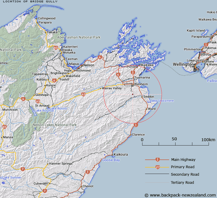
Map showing location of Bridge Gully


LINZ description: Flows north east into Nina Brook, south of Taylor Pass.
Latitude: -41.636918
Longitude: 173.956887
Northing: 5390092.9
Easting: 1679696.5
Land District: Marlborough
Feat Type: Valley


Scroll down to see a more detailed road map and below that a topographical map showing the location of Bridge Gully. The road map has been supplied by openstreetmap and the topographical map of Bridge Gully has been supplied by Land Information New Zealand (LINZ).

Yes you can use the top static map for you school/university project or personal website with a link back. Contact me for any commercial use.

Bridge Gully Map New Zealand


New Zealand places in our database
[ A ] [ B ] [ C ] [ D ] [ E ] [ F ] [ G ] [ H ] [ I ] [ J ] [ K ] [ L ] [ M ] [ N ] [ O ] [ P ] [ Q ] [ R ] [ S ] [ T ] [ U ] [ V ] [ W ] [ X ] [ Y ] [ Z ]


Closest 20 Valleys to Bridge Gully

Flaxey Gully ( 11.04km )   Captains Gully ( 11.12km )   Phillips Gully ( 18.6km )   Adams Gully ( 19.13km )   Matthews Gully ( 19.2km )   Haines Gully ( 24.82km )   Big Gully ( 25.78km )   Canterbury Gully ( 26.69km )   Swamp Gully ( 27.3km )   Sawcut Gorge ( 27.84km )   Happy Valley ( 29.94km )   Gorge Gully ( 29.97km )   Rough Gully ( 32.37km )   Joes Gully ( 33.17km )   Golden Gully ( 36.67km )   Strangers Gully ( 43.49km )   Maori Gully ( 44.6km )   Manuka Gully ( 45.15km )   Two Cottage Gully ( 49.87km )   Briary Gully ( 50.21km )   Ferret Gully ( 51.37km )   The Tongue ( 54.24km )   Rimu Gully ( 54.46km )   Cabbage Tree Gully ( 55.33km )   Dark Gully ( 56.98km )   Dead Horse Gully ( 58.22km )   Windtrap Gully ( 59.99km )   Travers Gully ( 60.06km )   Bull Gully ( 62.87km )   Spring Gully ( 64.82km )   Black Gully ( 69.36km )   Long Gully ( 69.46km )   Shepards Gully ( 71.22km )   Shaggery Gully ( 72.17km )   Long Gully ( 72.28km )   Fowl Gully ( 72.71km )   Middle Gully ( 72.76km )   Boundary Gully ( 73.09km )   Sheep Gully ( 73.4km )   Middle Gully ( 75.65km )