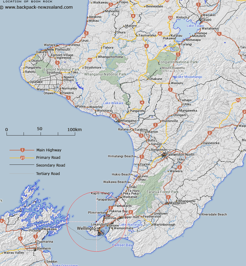
Map showing location of Boom Rock


LINZ description: Feature shown on: NZMS260 R27 R28 PtQ27
Latitude: -41.176528
Longitude: 174.739167
Northing: 5440188.5
Easting: 1745878.7
Land District: Wellington
Feat Type: Island


Scroll down to see a more detailed road map and below that a topographical map showing the location of Boom Rock. The road map has been supplied by openstreetmap and the topographical map of Boom Rock has been supplied by Land Information New Zealand (LINZ).

Yes you can use the top static map for you school/university project or personal website with a link back. Contact me for any commercial use.
Boom Rock Map New Zealand


New Zealand places in our database
[ A ] [ B ] [ C ] [ D ] [ E ] [ F ] [ G ] [ H ] [ I ] [ J ] [ K ] [ L ] [ M ] [ N ] [ O ] [ P ] [ Q ] [ R ] [ S ] [ T ] [ U ] [ V ] [ W ] [ X ] [ Y ] [ Z ]


Closest 20 Islands to Boom Rock

Mana Island ( 10.91km )   Mokopuna Island ( 13.4km )   Leper Island ( 13.4km )   Somes Island ( 13.94km )   Matiu/Somes Island ( 13.94km )   Makaro/Ward Island ( 17.13km )   M?karo / Ward Island ( 17.13km )   Ward Island ( 17.13km )   Taputeranga Island ( 19.48km )   Karori Rock ( 19.98km )   The Brothers ( 26.4km )   Arapaoa Island ( 34.61km )   Arapawa Island ( 34.61km )   Tahoramaurea Island (Browns Island) ( 34.75km )   Motungarara Island (Fishermans Island) ( 35km )   Motungarara Island ( 35.33km )   The Twins ( 35.46km )   Tokomapuna Island (Aeroplane Island) ( 36.53km )   Kokomohua Islands ( 37.02km )   Jordy Rocks ( 37.78km )   Matapara / Pickersgill Island ( 37.89km )   Pickersgill Island ( 37.89km )   Long Island ( 39.25km )   Kapiti Island ( 39.56km )   Motuara Island ( 40.05km )   Motuanaura Island ( 40.05km )   Walker Rock ( 40.46km )   Blumine Island (Oruawairua) ( 41.8km )   Oruawairua Island ( 41.8km )   Blumine Island ( 41.8km )   Bottle Rock ( 42.01km )   Amerikiwhati Island ( 42.13km )   Glasgow Island ( 43.33km )   Moioio Island ( 44.51km )   Walker Rock ( 50.21km )   Coombe Rocks ( 52.31km )   Horahora Kakahu Island ( 53.43km )   Titi Island ( 56.22km )   Allports Island ( 57.54km )   Shag Rock ( 59.22km )