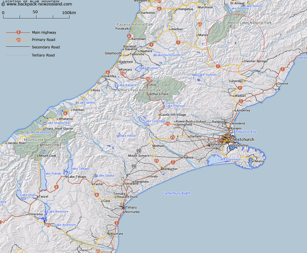
Map showing location of Blue Mountain


LINZ description: A hill 3/4 mile north of Mt Seymour.
Latitude: -42.290663
Longitude: 172.735004
Northing: 5317917
Easting: 1578153.8
Land District: Canterbury
Feat Type: Hill


Scroll down to see a more detailed road map and below that a topographical map showing the location of Blue Mountain. The road map has been supplied by openstreetmap and the topographical map of Blue Mountain has been supplied by Land Information New Zealand (LINZ).

Yes you can use the top static map for you school/university project or personal website with a link back. Contact me for any commercial use.

Blue Mountain Map New Zealand


New Zealand places in our database
[ A ] [ B ] [ C ] [ D ] [ E ] [ F ] [ G ] [ H ] [ I ] [ J ] [ K ] [ L ] [ M ] [ N ] [ O ] [ P ] [ Q ] [ R ] [ S ] [ T ] [ U ] [ V ] [ W ] [ X ] [ Y ] [ Z ]


Closest 20 Hills to Blue Mountain

Mount Seymour ( 1.23km )   Rabbit Hill ( 2.95km )   Mount Kruse ( 3.5km )   Mount Pickett ( 3.91km )   Mount Catley ( 4.12km )   Mount Laura ( 4.44km )   Eulalie Mound ( 5.06km )   Mount Saint George ( 5.18km )   Mount Stanley ( 5.24km )   Mount Clara ( 5.48km )   Birdcage ( 5.69km )   Mount Taliessin ( 6.18km )   Black Serpent ( 6.99km )   Lookout Hill ( 7.31km )   Lake Hill ( 7.71km )   Mount Horrible ( 8.26km )   Red Hill ( 9.26km )   Mount Sadd ( 9.36km )   Mount Northumberland ( 9.41km )   Mount Pollock ( 9.78km )   Mount Muntz ( 10.47km )   Mount Willmer ( 10.55km )   Mount Wilmer ( 10.55km )   Southey Mount ( 10.67km )   Mount McCabe ( 10.82km )   Tonga Hill ( 11.07km )   Mount Maria ( 11.47km )   Yanks Hill ( 11.5km )   Samoa Mound ( 11.55km )   Mount Sebastopol ( 12.57km )   Mount Federation ( 12.59km )   Mount Princess ( 12.88km )   Mount Moki ( 12.99km )   Mount Maling ( 13.2km )   Crystal Peak ( 13.78km )   Plinlimmon ( 14.07km )   Bunkers Hill ( 14.43km )   Aeneid Peak ( 14.54km )   Enid Peak ( 14.54km )   Duessa Peak ( 14.61km )