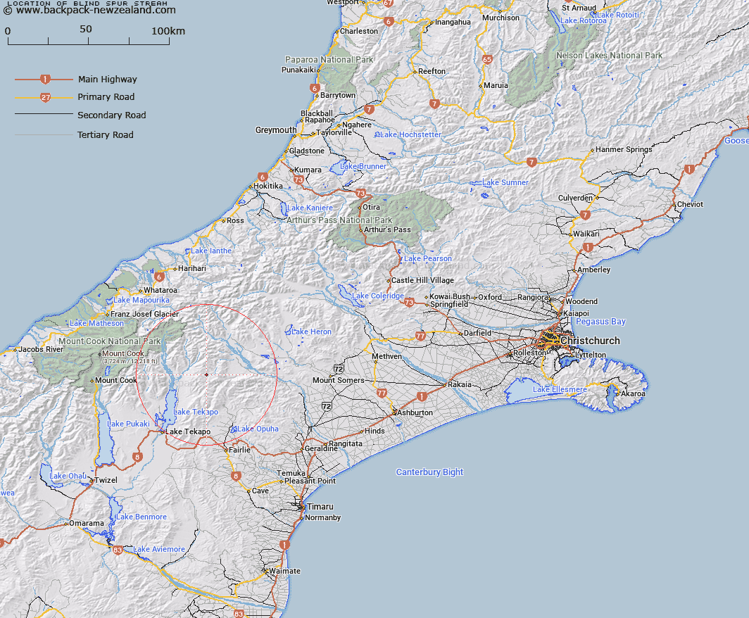
Map showing location of Blind Spur Stream


LINZ description: Left bank tributary of Bush Stream rising in the Two Thumb Range 1.5km South-west of Mount Toby, flowing South-eastward and joining Bush Stream 1.75km South-east of Trig. HA (Geodetic Code ANB1). Block II Fox Survey District.
Latitude: -43.701891
Longitude: 170.725011
Northing: 5158721.6
Easting: 1416691.8
Land District: Canterbury
Feat Type: Stream


Scroll down to see a more detailed road map and below that a topographical map showing the location of Blind Spur Stream. The road map has been supplied by openstreetmap and the topographical map of Blind Spur Stream has been supplied by Land Information New Zealand (LINZ).

Yes you can use the top static map for you school/university project or personal website with a link back. Contact me for any commercial use.

Blind Spur Stream Map New Zealand


New Zealand places in our database
[ A ] [ B ] [ C ] [ D ] [ E ] [ F ] [ G ] [ H ] [ I ] [ J ] [ K ] [ L ] [ M ] [ N ] [ O ] [ P ] [ Q ] [ R ] [ S ] [ T ] [ U ] [ V ] [ W ] [ X ] [ Y ] [ Z ]


Closest 20 Streams to Blind Spur Stream

Bush Stream ( 2.63km )   Sweeps Stream ( 6.22km )   Pack Horse Stream ( 6.77km )   Neutral Creek ( 6.79km )   Stone Hut Stream ( 7.13km )   First Waterfall Stream ( 7.24km )   Two Thumb Stream ( 7.81km )   Second Waterfall Stream ( 7.91km )   Third Waterfall Stream ( 8.04km )   North East Gorge Stream ( 8.96km )   Ribbonwood Stream ( 9.34km )   Camp Stream ( 9.36km )   Moonlight Stream ( 9.45km )   Scour Stream ( 11.49km )   Ninety Five Stream ( 11.63km )   Mount Gerald Stream ( 11.73km )   Stony Stream ( 11.98km )   Butlers Creek ( 12.21km )   Sawtooth ( 12.29km )   Forest Creek ( 12.67km )   Station Stream ( 13.5km )   Ajax Stream ( 13.51km )   Chevalier Stream ( 14.38km )   Black Birch Creek ( 14.54km )   Brabazon Stream ( 14.6km )   Trojan Stream ( 14.69km )   Coal River ( 14.98km )   Coal River ( 15.61km )   Tui Stream ( 16.28km )   Alma Stream ( 16.34km )   Lower Tindill Stream ( 17.09km )   Lookup Creek ( 17.11km )   Pikes Peak Stream ( 17.41km )   Toms Stream ( 17.75km )   Weka Stream ( 18.27km )   Little Hoggett Stream ( 18.9km )   Ribbonwood Creek ( 19.55km )   Phantom River ( 19.72km )   Godley River North Branch ( 19.8km )   Sutherland Creek ( 20.07km )