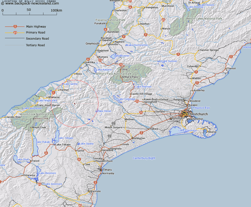
Map showing location of Billy McCoy Creek


LINZ description: An eastern tributary of McCoy Creek rising under the Armoury Range, just east of the Southern Alps/Kā Tiritiri o te Moana.
Latitude: -43.35759
Longitude: 170.814602
Northing: 5197154.8
Easting: 1422905.7
Land District: Canterbury
Feat Type: Stream


Scroll down to see a more detailed road map and below that a topographical map showing the location of Billy McCoy Creek. The road map has been supplied by openstreetmap and the topographical map of Billy McCoy Creek has been supplied by Land Information New Zealand (LINZ).

Yes you can use the top static map for you school/university project or personal website with a link back. Contact me for any commercial use.

Billy McCoy Creek Map New Zealand


New Zealand places in our database
[ A ] [ B ] [ C ] [ D ] [ E ] [ F ] [ G ] [ H ] [ I ] [ J ] [ K ] [ L ] [ M ] [ N ] [ O ] [ P ] [ Q ] [ R ] [ S ] [ T ] [ U ] [ V ] [ W ] [ X ] [ Y ] [ Z ]


Closest 20 Streams to Billy McCoy Creek

McCoy Stream ( 2.93km )   Sinclair River ( 3.41km )   Frances River ( 4.64km )   Tauroa Creek ( 5.34km )   Outlaw Creek ( 5.78km )   Agnes Stream ( 6.07km )   Argument Creek ( 6.19km )   Kirk Stream ( 6.23km )   Emily Creek ( 6.39km )   Cattle Creek ( 8.09km )   Mad Water ( 8.32km )   Moses Creek ( 8.95km )   Veil Stream ( 9.33km )   Coronation Stream ( 10.16km )   Shingly Stream ( 10.21km )   Lawrence River ( 10.23km )   Fury Torrent ( 10.39km )   Fan Stream ( 10.39km )   Lord River ( 10.95km )   Swift Water ( 10.97km )   Edison Stream ( 11.41km )   Havelock River ( 11.85km )   Wildsheep Stream ( 12.11km )   Clyde River ( 12.11km )   Reischek Stream ( 12.29km )   Aciphylla Creek ( 12.49km )   St Winifred Stream ( 13.88km )   Lambert River ( 14.17km )   Alpheus Creek ( 14.26km )   Eric Stream ( 14.48km )   Cloudy Stream ( 14.56km )   Tarn Creek ( 14.67km )   Benighted Creek ( 14.69km )   Potts River ( 14.75km )   Caper Torrent ( 15.06km )   Adams River ( 15.06km )   Boulderpool Creek ( 15.12km )   Lauper Stream ( 15.13km )   Louper Stream ( 15.13km )   Athene Creek ( 15.3km )