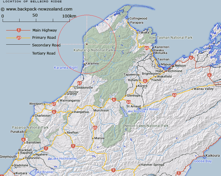
Map showing location of Bellbird Ridge


LINZ description: The main ridge between Pitt Creek and Wekakura Creek, leading from Trig. 782 (Geodetic Code A4UU) to near Heaphy River mouth. Whakapoai Survey District.
Latitude: -40.998328
Longitude: 172.138865
Northing: 5461071.4
Easting: 1527575
Land District: Nelson
Feat Type: Ridge


Scroll down to see a more detailed road map and below that a topographical map showing the location of Bellbird Ridge. The road map has been supplied by openstreetmap and the topographical map of Bellbird Ridge has been supplied by Land Information New Zealand (LINZ).

Yes you can use the top static map for you school/university project or personal website with a link back. Contact me for any commercial use.

Bellbird Ridge Map New Zealand


New Zealand places in our database
[ A ] [ B ] [ C ] [ D ] [ E ] [ F ] [ G ] [ H ] [ I ] [ J ] [ K ] [ L ] [ M ] [ N ] [ O ] [ P ] [ Q ] [ R ] [ S ] [ T ] [ U ] [ V ] [ W ] [ X ] [ Y ] [ Z ]


Closest 20 Ridges to Bellbird Ridge

Bellbird Ridge ( 0km )   Saxon Ridge ( 17.9km )   Grindley Ridge ( 18.74km )   False Peak ( 25.14km )   Grange Ridge ( 27.45km )   Garibaldi Ridge ( 30.15km )   Mount Stormy Range ( 33.16km )   Stormy Ridge ( 33.16km )   Kimbell Spur ( 34.9km )   K?k?p? Spur ( 36.33km )   Colosseum Ridge ( 37.67km )   Brown Cow Ridge ( 39.77km )   The Castles ( 40.68km )   Harris Ridge ( 41.95km )   Hardy Ridge ( 42.11km )   Kendall Ridge ( 43.56km )   Kiwi Ridge ( 43.77km )   Kill Devil Spur ( 44.19km )   Queen Ridge ( 45.69km )   Starvation Ridge ( 47.01km )   Walker Ridge ( 48.59km )   Luna Ridge ( 49.34km )   Parapara Ridge ( 50.67km )   Cowin Spur ( 52.24km )   Paddy Ridge ( 52.85km )   Johnson Ridge ( 53.28km )   Mount Gorgeous Range ( 53.28km )   Webb Ridge ( 53.53km )   Pearse Ridge ( 54.48km )   Jones Ridge ( 62.5km )   Evans Ridge ( 67.34km )   Radcliffe Ridge ( 67.57km )   Bald Knob Ridge ( 68.66km )   Rome Ridge ( 71.42km )   Newton Ridge ( 81.85km )   Blue Cliffs Ridge ( 82.01km )   Organs Spur ( 84.07km )   Sim Spur ( 84.67km )   Deepdale Ridge ( 93.58km )   Gibbs Spur ( 99.15km )