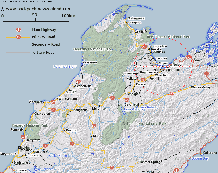
Map showing location of Bell Island


LINZ description: Small island in Waimea Inlet
Latitude: -41.293017
Longitude: 173.17318
Northing: 5428700
Easting: 1614500
Land District: Nelson
Feat Type: Island


Scroll down to see a more detailed road map and below that a topographical map showing the location of Bell Island. The road map has been supplied by openstreetmap and the topographical map of Bell Island has been supplied by Land Information New Zealand (LINZ).

Yes you can use the top static map for you school/university project or personal website with a link back. Contact me for any commercial use.

Bell Island Map New Zealand


New Zealand places in our database
[ A ] [ B ] [ C ] [ D ] [ E ] [ F ] [ G ] [ H ] [ I ] [ J ] [ K ] [ L ] [ M ] [ N ] [ O ] [ P ] [ Q ] [ R ] [ S ] [ T ] [ U ] [ V ] [ W ] [ X ] [ Y ] [ Z ]


Closest 20 Islands to Bell Island

Bests Island ( 1.5km )   Best Island ( 1.5km )   Saxton Island ( 2.28km )   Oyster Island ( 2.49km )   Pig Island ( 3.09km )   Moturoa / Rabbit Island ( 3.93km )   Rabbit Island ( 3.93km )   Rough Island ( 4.5km )   Bird Island ( 6.14km )   Arrow Rock (Fifeshire Rock) ( 7.41km )   Haulashore Island ( 7.58km )   Jackett Island ( 20.06km )   Pepin Island ( 26.54km )   Outer Island ( 28.38km )   K?k? Island ( 31.21km )   Ngaio Island ( 32.27km )   Fisherman Island ( 34.97km )   Motuareronui / Adele Island ( 35.92km )   Adele Island ( 35.92km )   Armchair Island ( 38.3km )   Ballon Rock ( 39.93km )   Pinnacle Island ( 41.44km )   Tonga Island ( 45.65km )   Moukirikiri Island ( 48.12km )   Motuanauru Island ( 48.18km )   Otuhaereroa Island ( 49.49km )   Wharenoa (Cemetery Island) ( 53.79km )   Tarakaip? Island ( 57.98km )   Ngawhiti Island ( 58.57km )   Tata Islands ( 58.81km )   Motu Island ( 58.93km )   Tawhitinui Island ( 59.12km )   Dart Rock ( 60.59km )   Le Brun Peninsula ( 63.66km )   Le Brun Island ( 63.66km )   Hautai Island ( 64.05km )   Cone Island ( 65.04km )   H?puka Island ( 66.72km )   Te Hoiere ( 66.85km )   Maud Island ( 66.85km )