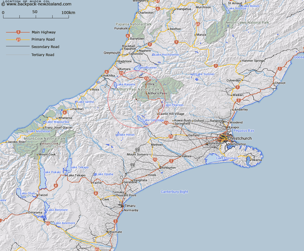
Map showing location of Avoca Col


LINZ description: At head of Avoca, giving access to Greenlaw Peak
Latitude: -43.017952
Longitude: 171.432847
Northing: 5236000
Easting: 1472300
Land District: Canterbury
Feat Type: Locality


Scroll down to see a more detailed road map and below that a topographical map showing the location of Avoca Col. The road map has been supplied by openstreetmap and the topographical map of Avoca Col has been supplied by Land Information New Zealand (LINZ).

Yes you can use the top static map for you school/university project or personal website with a link back. Contact me for any commercial use.

Avoca Col Map New Zealand


New Zealand places in our database
[ A ] [ B ] [ C ] [ D ] [ E ] [ F ] [ G ] [ H ] [ I ] [ J ] [ K ] [ L ] [ M ] [ N ] [ O ] [ P ] [ Q ] [ R ] [ S ] [ T ] [ U ] [ V ] [ W ] [ X ] [ Y ] [ Z ]


Closest 20 Localitys to Avoca Col

Arthur's Pass ( 13.42km )   Arthur Pass ( 13.42km )   Bealey Spur ( 16.09km )   Cora Lynn ( 18.75km )   Otira ( 23.31km )   Cass ( 26.32km )   Wainihinihi ( 29.96km )   Milltown ( 30.21km )   Jacksons ( 31.48km )   The Doughboy ( 32.05km )   The Doughboy/Kokiraki ( 32.05km )   Inchbonnie ( 32.61km )   Turiwhate ( 33.33km )   Craigieburn ( 35.86km )   Poerua ( 36.15km )   Hohonu ( 38.5km )   Kokatahi ( 38.54km )   Lake Coleridge ( 39.53km )   Avoca ( 39.54km )   Taramakau ( 40.17km )   Humphreys ( 42.03km )   Mitchells ( 42.49km )   Rotomanu ( 43.06km )   Greenstone (Pounamu) ( 44.02km )   Callaghans ( 44.93km )   Rimu ( 45.03km )   Woodstock ( 45.07km )   Dillmanstown ( 45.09km )   Goldsborough (Waimea) ( 45.89km )   Kanieri ( 46.2km )   Kaniere ( 46.2km )   Arthurstown ( 46.7km )   Te Kinga ( 46.9km )   Staircase ( 46.95km )   Kumara ( 47.5km )   Blue Spur ( 47.86km )   Stafford ( 47.95km )   Ruru ( 49.27km )   Moana ( 49.42km )   Otarama ( 49.91km )