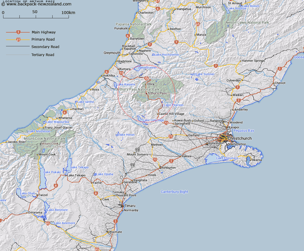
Map showing location of Arthur Pass


LINZ description: Locality situated 2.5km below Arthur's Pass, in the Bealy River valley.
Latitude: -42.946165
Longitude: 171.565399
Northing: 5244165
Easting: 1482965.1
Land District: Canterbury
Feat Type: Locality


Scroll down to see a more detailed road map and below that a topographical map showing the location of Arthur Pass. The road map has been supplied by openstreetmap and the topographical map of Arthur Pass has been supplied by Land Information New Zealand (LINZ).

Yes you can use the top static map for you school/university project or personal website with a link back. Contact me for any commercial use.

Arthur Pass Map New Zealand


New Zealand places in our database
[ A ] [ B ] [ C ] [ D ] [ E ] [ F ] [ G ] [ H ] [ I ] [ J ] [ K ] [ L ] [ M ] [ N ] [ O ] [ P ] [ Q ] [ R ] [ S ] [ T ] [ U ] [ V ] [ W ] [ X ] [ Y ] [ Z ]


Closest 20 Localitys to Arthur Pass

Bealey Spur ( 10.71km )   Cora Lynn ( 10.86km )   Otira ( 13.02km )   Avoca Col ( 13.42km )   Cass ( 18.47km )   Jacksons ( 23km )   Inchbonnie ( 25.87km )   Poerua ( 28km )   Wainihinihi ( 28.5km )   Craigieburn ( 29.47km )   Turiwhate ( 32.21km )   Milltown ( 33.14km )   Rotomanu ( 33.57km )   Avoca ( 35.05km )   Hohonu ( 36.94km )   Mitchells ( 37.21km )   Te Kinga ( 38.78km )   Taramakau ( 39.26km )   The Doughboy/Kokiraki ( 41.05km )   The Doughboy ( 41.05km )   Ruru ( 41.24km )   Greenstone (Pounamu) ( 41.57km )   Moana ( 41.83km )   Bell Hill ( 43.05km )   Staircase ( 43.23km )   Kopara ( 44.02km )   Dillmanstown ( 44.5km )   Humphreys ( 44.91km )   Kokatahi ( 45.17km )   Kotuku ( 45.22km )   Aratika ( 45.43km )   Callaghans ( 45.56km )   Kumara ( 46.73km )   Lake Coleridge ( 46.76km )   Haupiri ( 47.11km )   Goldsborough (Waimea) ( 47.39km )   Otarama ( 47.59km )   Kowai Bush ( 48.52km )   Kaimata ( 48.65km )   Dunganville ( 48.67km )