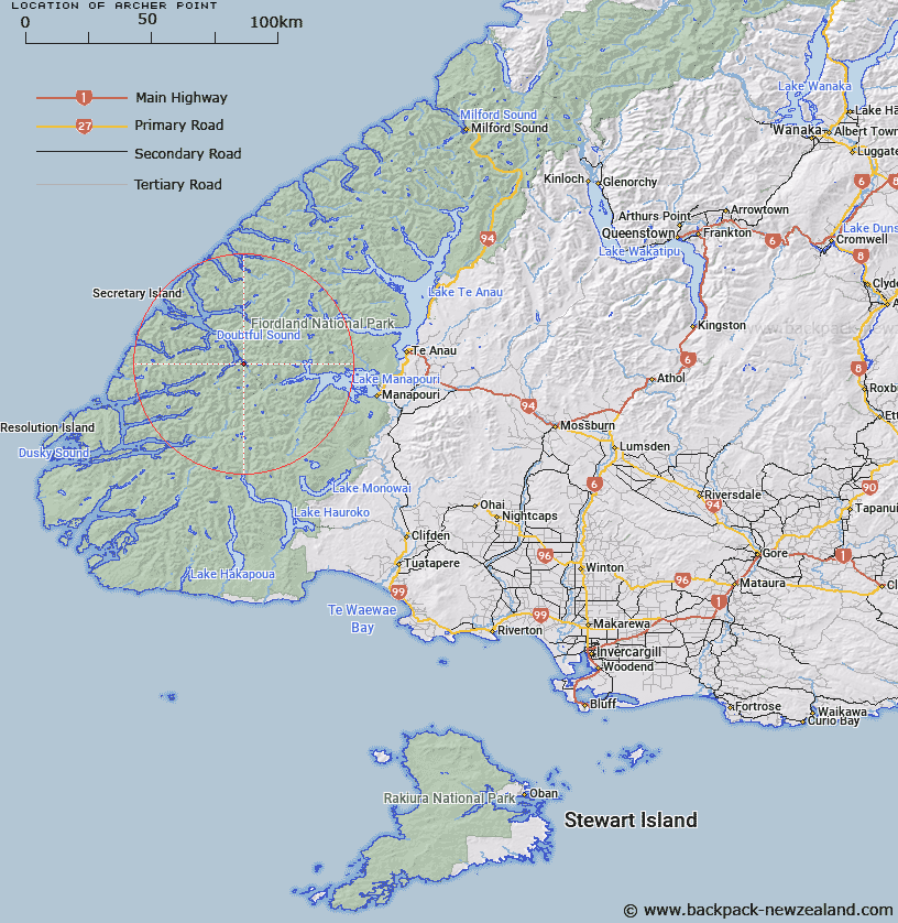
Map showing location of Archer Point


LINZ description: Point in Deep Cove, Doubtful Sound, approximately 1km north-west of Brasell Point.
Latitude: -45.455272
Longitude: 167.150493
Northing: 4949804.8
Easting: 1142647.6
Land District: Southland
Feat Type: Point


Scroll down to see a more detailed road map and below that a topographical map showing the location of Archer Point. The road map has been supplied by openstreetmap and the topographical map of Archer Point has been supplied by Land Information New Zealand (LINZ).

Yes you can use the top static map for you school/university project or personal website with a link back. Contact me for any commercial use.

Archer Point Map New Zealand


New Zealand places in our database
[ A ] [ B ] [ C ] [ D ] [ E ] [ F ] [ G ] [ H ] [ I ] [ J ] [ K ] [ L ] [ M ] [ N ] [ O ] [ P ] [ Q ] [ R ] [ S ] [ T ] [ U ] [ V ] [ W ] [ X ] [ Y ] [ Z ]


Closest 20 Points to Archer Point

Brasell Point ( 1km )   Pridham Point ( 1.77km )   Davidson Head ( 3.37km )   Brig Point ( 3.94km )   Turn Point ( 11.9km )   Kellard Point ( 14.25km )   Ranson Head ( 14.95km )   Cavellia Head ( 17.39km )   Master Head ( 19.19km )   Espinosa Point ( 19.19km )   Woodhead Point ( 19.19km )   Glynn Point ( 19.27km )   Pack Point ( 19.83km )   Gardener Head ( 19.9km )   Evans Head ( 19.9km )   Sharp Head ( 20.12km )   Joseph Point ( 20.96km )   Common Head ( 20.98km )   Richards Point ( 21.24km )   Quintano Point ( 21.73km )   Rogers Point ( 21.81km )   Seventy Fathoms Point ( 22.11km )   Schooner Point ( 22.12km )   Marcaciones Point ( 23.12km )   Flurry Head ( 23.12km )   Chatham Point ( 23.28km )   Otago Point ( 23.58km )   Discovery Point ( 24.44km )   Lieutenant Head ( 26.23km )   Phillips Point ( 27.54km )   Adieu Point ( 27.68km )   Jamieson Head ( 28.04km )   Calderwood Peninsula ( 28.93km )   Castoff Point ( 30.74km )   Bend Point ( 31.11km )   Black Point ( 31.12km )   Febrero Point ( 31.13km )   Towing Head ( 31.37km )   Peninsula Point ( 32.62km )   Moa Point ( 33.13km )