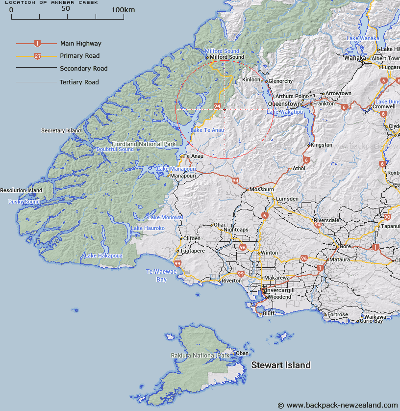
Map showing location of Annear Creek


LINZ description: Rising about two miles east of Countess Peak and flowing northerly into East Branch Eglinton River. Swinton Survey District.
Latitude: -45.063324
Longitude: 168.058349
Northing: 4998123.8
Easting: 1210952.4
Land District: Southland
Feat Type: Stream


Scroll down to see a more detailed road map and below that a topographical map showing the location of Annear Creek. The road map has been supplied by openstreetmap and the topographical map of Annear Creek has been supplied by Land Information New Zealand (LINZ).

Yes you can use the top static map for you school/university project or personal website with a link back. Contact me for any commercial use.

Annear Creek Map New Zealand


New Zealand places in our database
[ A ] [ B ] [ C ] [ D ] [ E ] [ F ] [ G ] [ H ] [ I ] [ J ] [ K ] [ L ] [ M ] [ N ] [ O ] [ P ] [ Q ] [ R ] [ S ] [ T ] [ U ] [ V ] [ W ] [ X ] [ Y ] [ Z ]


Closest 20 Streams to Annear Creek

Annear Creek ( 0km )   Mackay Creek ( 4.5km )   Black Creek ( 4.99km )   Wesney Creek ( 6.99km )   Winton Burn ( 7.47km )   Windon Burn ( 7.47km )   Eglinton River East Branch ( 8.22km )   Kiosk Creek ( 8.95km )   Walker Creek ( 9.05km )   Boyd Creek ( 11.34km )   Mararoa River ( 11.37km )   Eglinton River West Branch ( 11.57km )   Smithy Creek ( 11.94km )   Eglinton River ( 12.26km )   Nurse Creek ( 13.28km )   Murcott Burn ( 14.13km )   Pond Burn ( 14.22km )   Hen Burn ( 14.47km )   Greenstone River ( 16.53km )   Plato Creek ( 16.54km )   Pass Burn ( 16.77km )   West Burn ( 16.77km )   Dunton Creek ( 17.03km )   Waterfall Creek ( 17.22km )   Cascade Creek ( 17.55km )   Sly Burn ( 17.61km )   Trench Burn ( 17.63km )   Glade Burn ( 18.07km )   Hut Creek ( 18.9km )   Von River North Branch ( 19.62km )   Billy Burn ( 19.83km )   Steele Creek ( 20.01km )   Mistake Creek ( 20.47km )   Retford Stream ( 20.6km )   Slip Stream ( 20.64km )   Hut Burn ( 21.83km )   Clinton River ( 22.01km )   Duck Creek ( 22.03km )   McKellar Branch;Greenstone River ( 22.38km )   Melita Stream ( 22.72km )