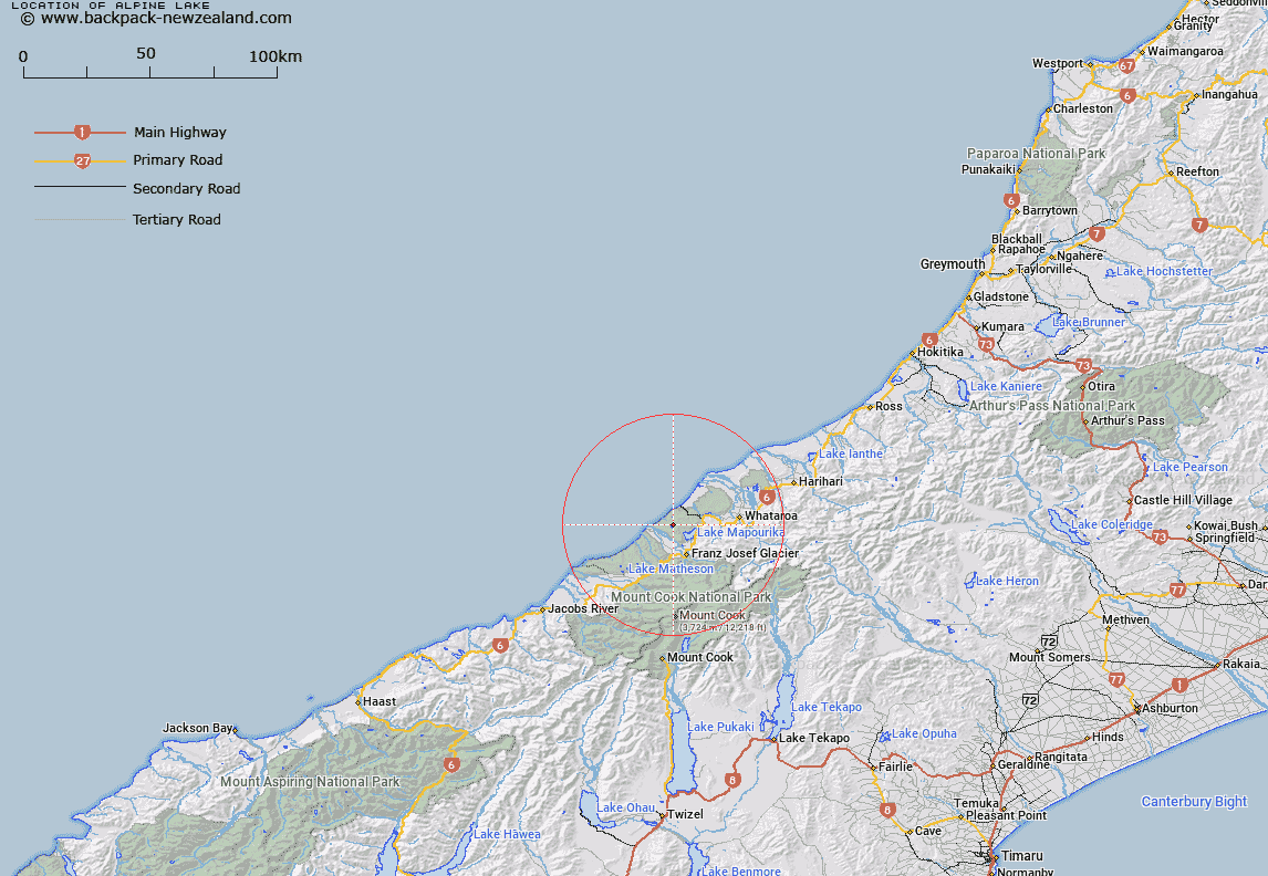
Map showing location of Alpine Lake


LINZ description: Feature shown on: NZMS260-H35 777650; NZTopo50-BW15 677033;
Latitude: -43.287287
Longitude: 170.136682
Northing: 5203300
Easting: 1367700
Land District: Westland
Feat Type: Lake


Scroll down to see a more detailed road map and below that a topographical map showing the location of Alpine Lake. The road map has been supplied by openstreetmap and the topographical map of Alpine Lake has been supplied by Land Information New Zealand (LINZ).

Yes you can use the top static map for you school/university project or personal website with a link back. Contact me for any commercial use.

Alpine Lake Map New Zealand


New Zealand places in our database
[ A ] [ B ] [ C ] [ D ] [ E ] [ F ] [ G ] [ H ] [ I ] [ J ] [ K ] [ L ] [ M ] [ N ] [ O ] [ P ] [ Q ] [ R ] [ S ] [ T ] [ U ] [ V ] [ W ] [ X ] [ Y ] [ Z ]


Closest 20 Lakes to Alpine Lake

Lake Miro ( 3.51km )   Five Mile Lagoon ( 3.96km )   Three Mile Lagoon ( 4.57km )   Lake Mapourika ( 5.99km )   Lake Pratt ( 7.67km )   Lake Wahapo ( 11.25km )   Okarito Lagoon ( 12.56km )   ?k?rito Lagoon ( 12.56km )   Lake Wombat ( 13.13km )   Peters Pool ( 15.01km )   Lake Windemere ( 16.73km )   ?k?ritoiti / Lake Windermere ( 16.73km )   Lake Mueller ( 17.01km )   Lake Gibb ( 17.08km )   Lake Gibbs ( 17.08km )   Lake Gault ( 20.05km )   Aorangi Lagoon ( 20.27km )   Lake Lyttle ( 20.72km )   Lake Matheson ( 21.85km )   Lake Joan ( 25.46km )   Lake Darby ( 25.54km )   Saltwater Lagoon ( 27.49km )   White Heron Lagoon ( 27.51km )   Lake Rotokino ( 27.81km )   Lake Barrowman ( 29.44km )   Saddle Lake ( 30.34km )   Ice Lake ( 30.93km )   Hikimutu Lagoon ( 31.97km )   Abel Lake ( 40.99km )   Hooker Lake ( 44.14km )   Blue Lakes ( 45.28km )   Tasman Lake ( 46.05km )   Lake Ianthe/Matahi ( 47.17km )   Lake Ianthe ( 47.17km )   Sealy Tarns ( 47.66km )   Lake Roto Te Koeti ( 49.39km )   Lake Rototekoiti ( 49.39km )   Red Tarns ( 51.28km )   Lake Kini ( 54.33km )   Ounatai Lagoon ( 54.35km )