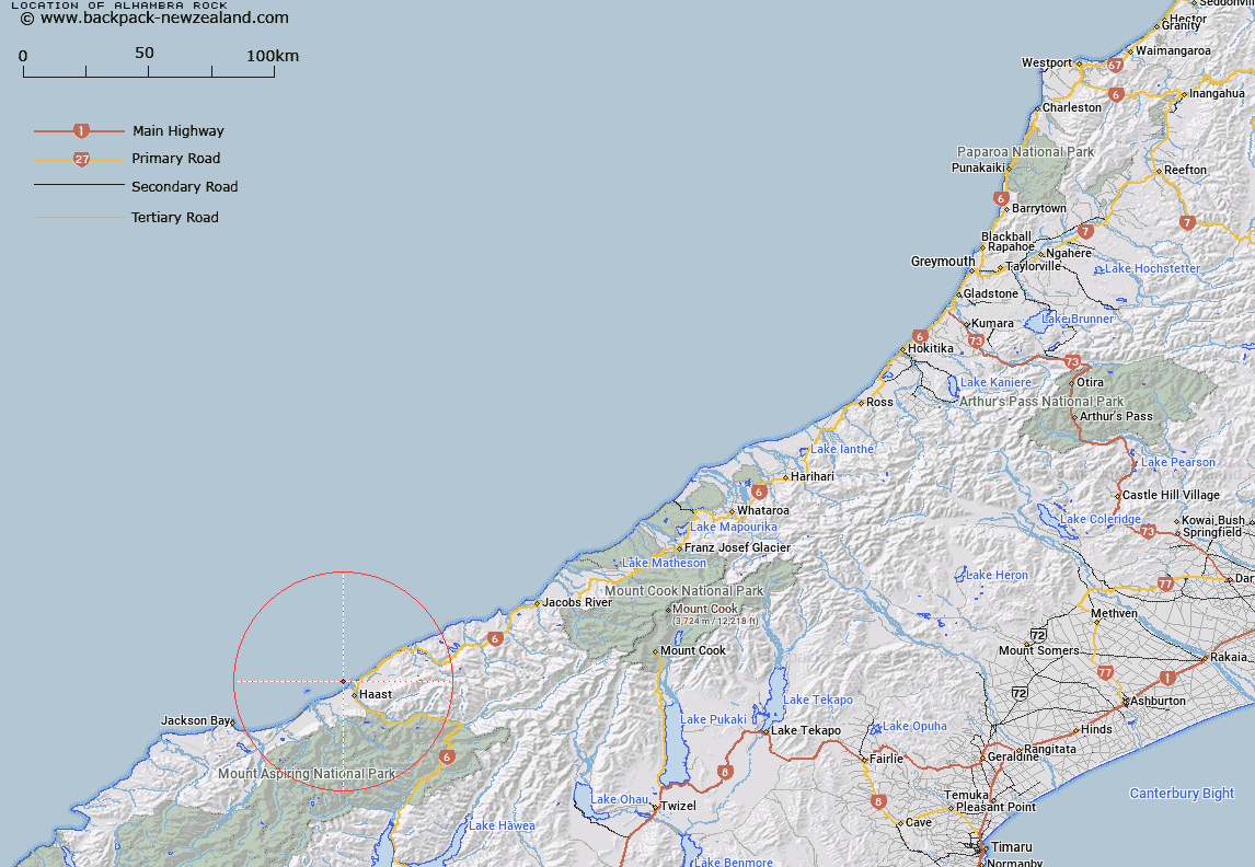
Map showing location of Alhambra Rock


LINZ description: Rock approximately 2.25km out from the mouth of the Haast River
Latitude: -43.833033
Longitude: 169.001749
Northing: 5138897.1
Easting: 1278535.3
Land District: Westland
Feat Type: Rock


Scroll down to see a more detailed road map and below that a topographical map showing the location of Alhambra Rock. The road map has been supplied by openstreetmap and the topographical map of Alhambra Rock has been supplied by Land Information New Zealand (LINZ).

Yes you can use the top static map for you school/university project or personal website with a link back. Contact me for any commercial use.

Alhambra Rock Map New Zealand


New Zealand places in our database
[ A ] [ B ] [ C ] [ D ] [ E ] [ F ] [ G ] [ H ] [ I ] [ J ] [ K ] [ L ] [ M ] [ N ] [ O ] [ P ] [ Q ] [ R ] [ S ] [ T ] [ U ] [ V ] [ W ] [ X ] [ Y ] [ Z ]


Closest 20 Rocks to Alhambra Rock

Alhambra Rock ( 0km )   Abbey Rocks ( 32.38km )   White Slip ( 69.92km )   Redoubt Pinnacles ( 71.23km )   The Sentinel ( 71.79km )   Cutter Rocks ( 71.87km )   The Steeples ( 74.25km )   Kelp Rock ( 74.29km )   Scotts Slip ( 87.62km )   Red Slip ( 87.73km )   Crayfish Rock ( 88.11km )   Rock Etam ( 92.51km )   Penguin Rock ( 93.4km )   Clarke Slip ( 93.85km )   Smoky Rock ( 95.26km )   Tomnahurich Rock ( 96.52km )   Great Rock ( 97.47km )   Wilson Rock ( 103.88km )   Teichelmann Rock ( 104.41km )   Moses Rock ( 108.11km )   Lion Rock ( 110.25km )   Fatboy Rock ( 110.78km )   Slab Lookout ( 112.93km )   Dome Rock ( 114.15km )   Blue Slip ( 116.11km )   Pawnbroker Rock ( 116.76km )   Column Rocks ( 118.77km )   Gordon Rock ( 121.73km )   Horace Greeley Slip ( 123.96km )   The Lighthouse ( 124.25km )   Castle Rock ( 124.3km )   Chalmers Leap ( 130.42km )   Monkey Rock ( 130.81km )   Parsons Rock ( 132.24km )   Castle Rock ( 132.64km )   Black Rocks ( 133.57km )   Bell Rock ( 138.39km )   The Stone Man ( 139.32km )   Leaning Rock ( 139.98km )   Leaning Rock/Haehaeata ( 139.98km )