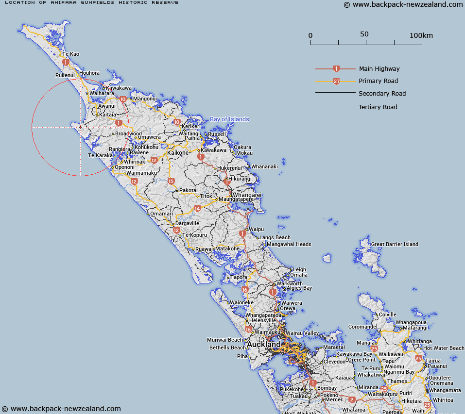
Map showing location of Ahipara Gumfields Historic Reserve


LINZ description: Historic Reserve, Sec 13 Blk VII AHIPARA SURVEY DISTRICT, Was 1982 p.2715
Latitude: -35.206389
Longitude: 173.134722
Northing: 6104060.5
Easting: 1612262.7
Land District: North Auckland
Feat Type: Historic Reserve


Scroll down to see a more detailed road map and below that a topographical map showing the location of Ahipara Gumfields Historic Reserve. The road map has been supplied by openstreetmap and the topographical map of Ahipara Gumfields Historic Reserve has been supplied by Land Information New Zealand (LINZ).

Yes you can use the top static map for you school/university project or personal website with a link back. Contact me for any commercial use.

Ahipara Gumfields Historic Reserve Map New Zealand


New Zealand places in our database
[ A ] [ B ] [ C ] [ D ] [ E ] [ F ] [ G ] [ H ] [ I ] [ J ] [ K ] [ L ] [ M ] [ N ] [ O ] [ P ] [ Q ] [ R ] [ S ] [ T ] [ U ] [ V ] [ W ] [ X ] [ Y ] [ Z ]


Closest 20 Historic Reserves to Ahipara Gumfields Historic Reserve

Pairatahi Gum Historic Reserve ( 25.42km )   Muiata Pa Historic Reserve ( 38.27km )   Cable Bay Historic Reserve ( 39.86km )   Kohukohu Historic Reserve ( 40.8km )   Rangikapiti Pa Historic Reserve ( 43.22km )   Mangonui Court House Historic Reserve ( 43.79km )   Akat?rere Historic Reserve ( 53.18km )   Akatere Historic Reserve ( 53.18km )   Okuratope Pa Historic Reserve ( 66.98km )   Kerikeri Wharf Historic Reserve ( 75.24km )   Kororipo Pa Historic Reserve ( 75.52km )   Edmonds Ruins Historic Reserve ( 80.46km )   Akeake Historic Reserve ( 82.83km )   Motumaire Historic Reserve ( 87.46km )   Marsden Cross Historic Reserve ( 87.55km )   Tapeka Point Historic Reserve ( 89.59km )   Flagstaff Hill Historic Reserve ( 89.71km )   Pompallier House Historic Reserve ( 89.92km )   Okiato Point Historic Reserve ( 90.08km )   Waikare Historic Reserve ( 93.26km )   Harata Historic Reserve ( 94.79km )   Kahuwhera Pa Historic Reserve ( 94.93km )   Ruapekapeka Historic Reserve ( 95.41km )   Kaipara North Head Lighthouse Historic Reserve ( 159.06km )   Mahurangi River Historic Reserve ( 193.07km )   Kawau Island Historic Reserve ( 204.29km )   Smeltinghouse Historic Reserve ( 204.33km )   Onepoto Historic Reserve ( 225.63km )   S.S. Wairarapa Graves (Tapuwai Point) Historic Reserve ( 230.26km )   Fort Takapuna Historic Reserve ( 233.39km )   North Head Historic Reserve ( 235.06km )   Maungauika / North Head Historic Reserve ( 235.06km )   Matietie Historic Reserve ( 241.32km )   Stony Batter Historic Reserve ( 252.21km )   Wiri Historic Reserve ( 252.95km )   St Johns Redoubt Historic Reserve ( 253.65km )   Waiau Pa Historic Reserve ( 258.16km )   Pratts Road Historic Reserve ( 272.08km )   School Of Mines Historic Reserve ( 273.89km )   Cameron Town Historic Reserve ( 277.12km )